This is a good point and may be a potential reason why they have not included the monitor yet.
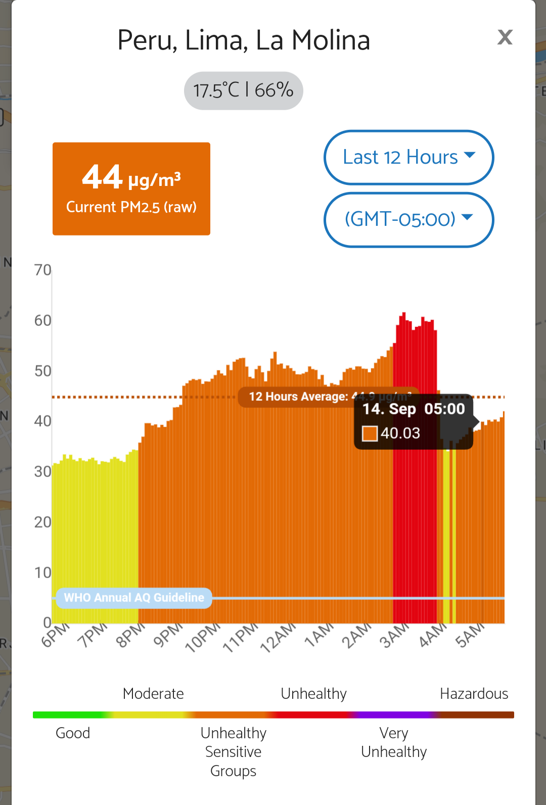
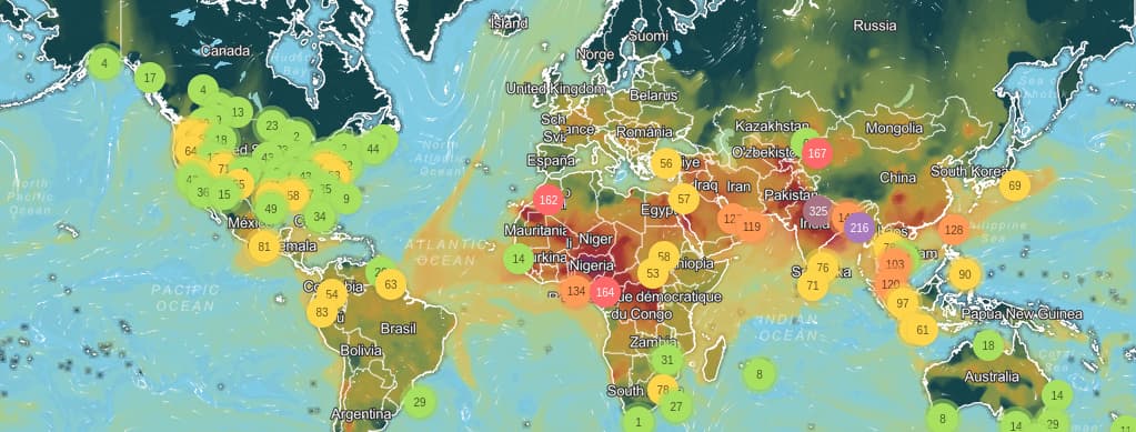
While around my region there is no other monitor, IQAir does have their own model based on satellite imagery to estimate PM and US AQI.
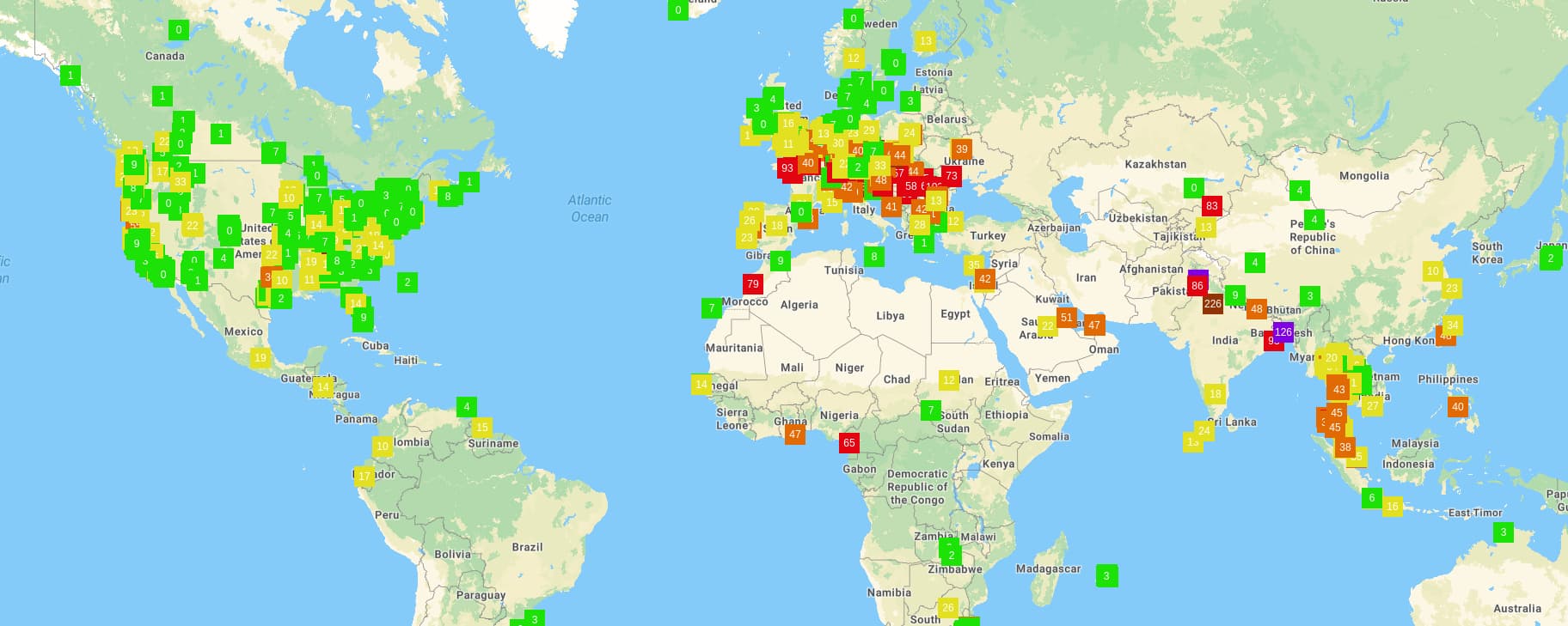
If I check those estimated values, they are approximately in line with the corrected PM2.5 I found on the AG map.
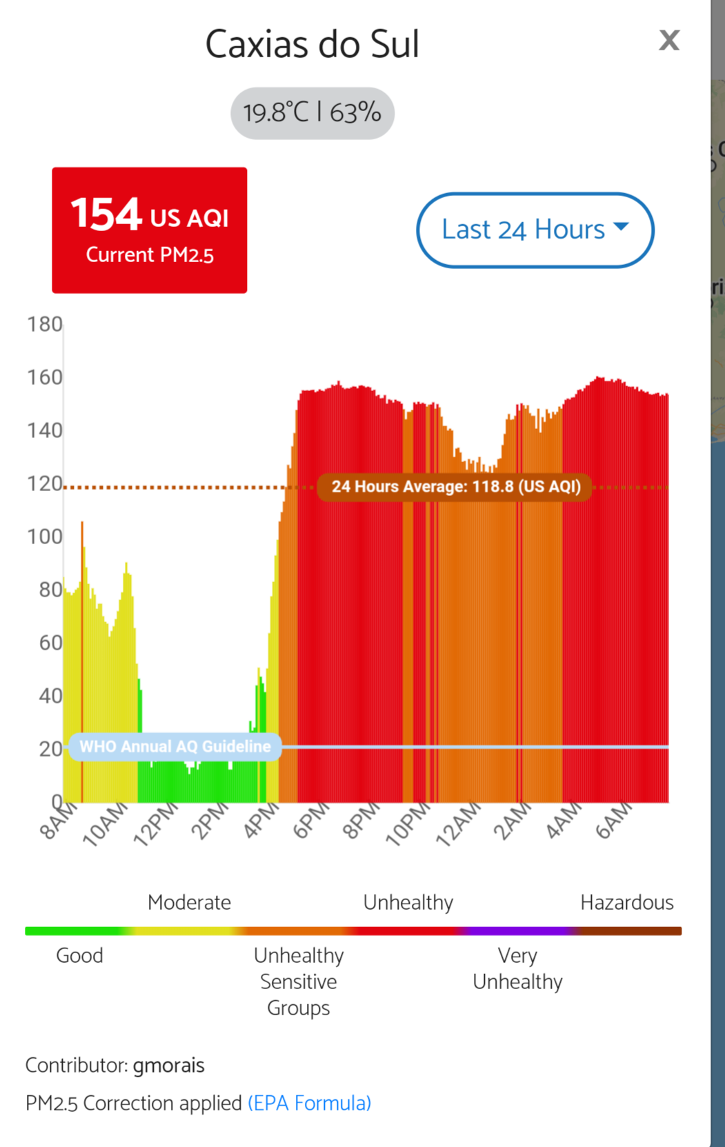
However, as I noticed on the OpenAQ map, the corrected values are not the ones been streamed, but rather the raw ones. So I believe these would also be the ones IQAir would receive?
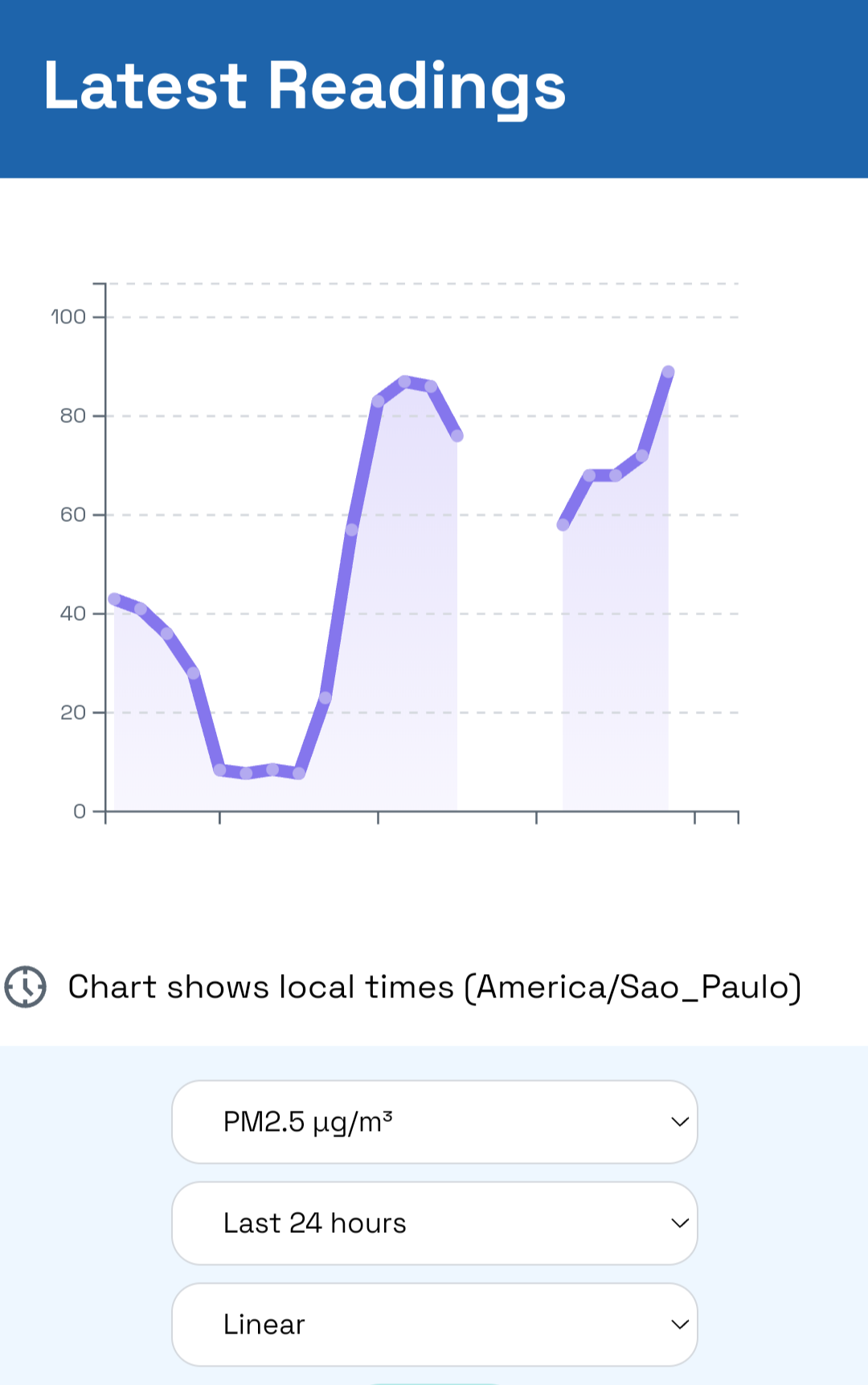
If that’s the case, they may have observed overestimated values for PM and AQI in comparison to their own - I believe the raw values in my region right now (120u/m3) could represent AQI close to 200, whereas the corrected values are 90u/m3 and 169, respectively, and their model estimates an AQi of 168.
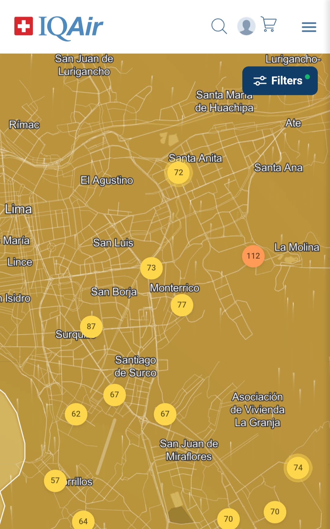
Maybe under normal conditions of low AQI values, the observed differences wouldn’t be an issue. But in our wildfire case, in which cities in Brazil were ranked to have the worst quality in the world this week (by IQAir itself), then such discrepancy may play a bigger role if included.
But what I don’t understand: why does AG (apparently) stream the uncorrected values to other maps, as we are aware these to be overestimated, and therefore could lead to both misunderstanding from readers as well as failing validation with other stations / satellite models?
For example, if I compare PurpleAir monitors in Brazil on IQAir map, they do seem to present very consistent values with those I found on PurpleAir map for EPA corrected AQI, thus leading to believe they stream corrected values too.
Would it be possible for AG to stream the corrected PM2.5 values from AG to IQAir (and other maps) too?


 . It’s their fault. OpenAQ is also up to date.